
Hamidul Haque


I am a Water Resources Engineer who works with different modeling tools for decision making and iterative research. I am also a data enthusiast and like to experiment on data to see what it offers in parallel to process-based modeling for improved decision making.
Latest News & Updates |
Second Part of Google Earth Engine Tutorial in Bangla published in YouTube at official channel of WRE Forum
First Bangla Tutorial on Google Earth Engine for Beginner, Published as Part of My Collaboration with WRE Forum.
Recently posted
Abstract got accepted for presentation at EGU General Assembly 2021 to be held on 19-30 April 2021.
Development of Flood Forecasting System for Someshwari-Kangsa Sub-watershed of Bangladesh-India Using Different Machine Learning Techniques.
AHYDTECH has been awarded it's first world bank project in Bangladesh.
Jamuna River Economic Corridor Development Program: Consultancy Services to Support the Due Diligence in Preparation of Component 1: Riverbank Protection and River Training.
Highlights: Morphology of Jamuna River will be analyzed using hydodynamic and sediment transport models.
Google Earth Engine Tutorial in Bangla published in YouTube at official channel of WRE Forum
First Bangla Tutorial on Google Earth Engine for Beginner, Published as Part of My Collaboration with WRE Forum.
Presented my work at AGU Fall Meeting 2020 on the elightening session under H187- Science and Applications Results from the NASA Soil Moisture Active Passive (SMAP) Satellite Mission II chaired by Dara Entekhabi of MIT.
Highlights
I have been awarded the Virtual Berkner Travel Fellowship to participate in the 2020 American Geophysical Union (AGU) Fall Meeting, 1-17 December 2020.
Abstract got accepted for presentation at AGU Fall Meeting 2020 to be held on 1-17 December 2020.
Correction of SMAP (Soil Moisture Active Passive) Satellite Retrieved Soil Moisture Data using ANN Technique over North West Region of Bangladesh
Professional Experience
Working as a Water Resources Engineer at AHYDTECH Water Resources BD Ltd. (October 2017- Present), a sister concern of Ontario based company AHYDTECH Geomorphic Ltd. I worked on several projects on watershed hydrology, flood plain mapping and risk assessment,flood forecasting system development, sediment transport and morphological analysis of river, coastal analysis, and coastal structure design. Highlights of my responsibilities are the following:
- Assessed the hydrological and meteorological conditions, issues in data types, processed the data, developed the database, and processed geospatial data using ArcGIS and Google Earth Engine;
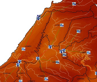
- Developed hydrological models using HEC-HMS and HEC-GeoHMS;
- Sensitivity analysis, calibration, and validation of the developed hydrologic models
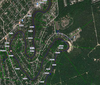
- Developed 1D and 2D Hydrodynamic models using HEC-RAS 1D, SMS SRH 2D, and TUFLOW for flood inundation mapping and hydrodynamic properties analysis;
- Extracted topographic data from LiDAR or Orthophoto based DTM data, topo-graphic and bathymetric surveying data;
- Background study of the existing documents and data, data collection and processing, pre and post-processing of model, and morphological analysis of river using SMS SRH 2D and TUFLOW based sediment transport models;
- Generated flood inundation maps, preparation of technical reports, technical presentation & training and communicating with the client and
- Technical proposal writing for more than thirty (30) proposals of different scopes.
- Led a team of Engineers and GIS analyst to develop hydrological models using HEC-HMS and HEC-GeoHMS;
- Trained the technical team, monitoring, and reviewing the work of the technical team to develop the hydrologic models and technical proposals, and
- Designed the procedures to be followed to develop models, task scheduling, and team management;
Floodplain Mapping and Watershed Hydrology
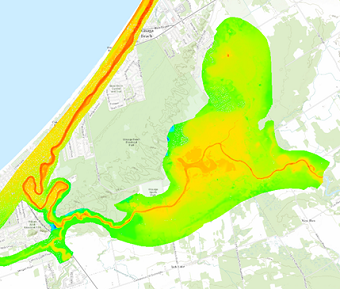
1. Project Name: Wasaga Beach Floodplain Mapping and Watershed Hydrology Study.
Funding Agency: Nottawasaga Valley Conservation Authority.
Key Technical Tasks Perfomred: Developed of Hydrologic Models using HEC-HMS, and Hydrodynamic Models using HEC-RAS 1D and SRH 2D, Extracted floodplain maps for different return period storms, and Technical report writing.
2. Project Name: Salmon River Watershed Hydrologic Modeling.
Funding Agency: Quinte Conservation.
Key Technical Tasks Perfomred: Updated existing Hydrologic Model using HEC-HMS, and addressed comments and Technical report writing.
3. Project Name: Cooksville Creek Floodplain Mapping.
Funding Agency: Private property owner of 1468 Elaine Trail, Mississauga, Ontario.
Key Technical Tasks Perfomred: Updated existing HEC-RAS 1D model using updated bathymetry data, floodplain mapping for different return period storms, and Technical report writing.
4. Project Name: Development Hydrologic Model of Harriston Subwatershed.
Funding Agency: Maitland Valley Conservation Authority.
Key Technical Tasks Perfomred: Developed Hydrologic Models using HEC-HMS for different return period and regional storms, and Technical report writing.
5. Project Name: Class EA Flood Remediation Project- Watercourse 11, Fifty Point Conservation Area.
Funding Agency: Hamilton Conservation Authority.
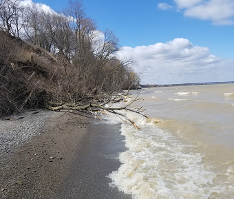
Key Technical Tasks Perfomred: Analyzed wave uprush of the outlet to Lake Ontario to aid flood hazard analysis from Lake, Analyzed floodplain maps for different return period storms, reviewed guidelines and previous reports, and Technical report writing.
6. Project Name: Buells and Butlers Creek Floodplain Mapping Update.
Funding Agency: Cataraqui Region Conservation Authority and City of Brockville.
Key Technical Tasks Perfomred: Led a team to develop Hydrologic Models using HEC-HMS, and Hydrodynamic Models using HEC-RAS 1D and SRH 2D, Extracted floodplain maps for different return period storms, and Technical report writing.
7. Project Name: Beeton Creek Floodplain Mapping Update.
Funding Agency: Nottawasaga Valley Conservation Authority.
Key Technical Tasks Perfomred: Developed of Hydrologic Models using HEC-HMS, and Hydrodynamic Models using and SRH 2D, Extracted floodplain maps for different return period storms, and Technical report writing.
8. Project Name: Swarnodwip Development Project- Drainage Design and Coastal Hazard Analysis.
Funding Agency: Bangladesh Army.
Key Technical Tasks Perfomred: It was a three-month long crash project for a remote island at the Bay of Bengal. I developed hydrologic model using HEC-HMS and helped to develop the SRH 2D models to scenario analysis for tide dominant outlets.
9. Project Name: Development of Hydrological Models (HEC-HMS) for Three Major Basins (Bramhaputra, Ganges, and Meghna) of Bangladesh.
Funding Agency: Internal Research Fund of AHYDTECH.
Key Technical Tasks Perfomred: Led a team to develop Three independent Hydrologic Models using HEC-HMS. I designed the whole project from scratch based on my experience in previous projects. This included a review of the previous studies, developing methods to be followed, identifying the geospatial and climate data source for big basins like Brahmaputra (651,334 SqKM), Ganges (1087,300 SqKM) and Meghna (82,000 SqKM), debugging the model and finally, calibration and validation. This internal research project aims to update the calibration each year with new and updated available data series. Total of four engineers worked (or working) under my supervision intermittently.
Sediment Transport and Morphological Analysis Projects
1. Project Name: Sediment Transport Analysis and Natural Channel Design of Brahmaputra-Jamuna River of Bangladesh.
Funding Agency: Internal Research Fund of AHYDTECH.
Key Technical Tasks Perfomred: Pre-processed flow data from developed Hydrologic Models of Brahmaputra Basin developed using HEC-HMS, pre and post processing of Hydrodynamic Models developed using SRH 2D and TUFLOW, and prepared technical presentation.This is also an iterative research projects which aims to develop gradually with the updated data and technologies.
2. Project Name: Development of a Sediment Transport Model for Feasibility Study of the Navigation Route from Paturia to Baghabari using TUFLOW for the Improvement of Navigability as Class-I (jointly with CEGIS)
Funding Agency: Bangladesh Inland Water Transport Authority.
Key Technical Tasks Perfomred: Wrote the Technical Proposal with CEGIS (Center for Environmental and Geographic Information Services) staffs, Pre-processed flow data from BWDB station data and developed Hydrologic Models of Brahmaputra Basin developed using HEC-HMS, participated in field data collection with survey team, aid in Hydrodynamic Model development using TUFLOW, and prepared technical presentation.
3. Project Name: Jamuna River Economic Corridor Development Program: Consultancy Services to Support the Due Diligence in Preparation of Component 1: Riverbank Protection and River Training.
Funding Agency: World Bank.
Coastal Engineering Projects
1. Coastal Engineering Analysis and Vertical Sea Wall Design for 645 Grays Road, Ontario, Canada.
2. Coastal Engineering Analysis and Seawall Design for 56 Seabreeze Crescent, Ontario, Canada.
3. Coastal Engineering Analysis and Vertical Sea Wall Design for 24 Trillium Avenue, Ontario, Canada.
4. Coastal Engineering Analysis and Vertical Sea Wall Design for 531 Winona Road, Ontario, Canada.
5. Coastal Engineering Analysis and Seawall Design for 1176 Lakeside Dr., Ontario, Canada.
6. Coastal Engineering Analysis and Seawall Design for 56 Seabreeze Crescent, Ontario, Canada.
7. Coastal Engineering Analysis and Seawall Design for 43 Windemere, Ontario, Canada.
8. Coastal Engineering Analysis and Revetment Design for 16-18 Lakeside Drive, Stoney Creek, Ontario, Canada.
Professional Presentations
1. M. H. Haque, S T Islam, K P Mondal, “Alternatives and Scenarios Analysis for Drainage Masterplan Design Focusing Low Impact Development (LID) at Navy Properties of Chittagong Coastal Area” to Bangladesh Navy.
2. S M Bahar, M. H. Haque, A Hossain, “HEC-HMS, HEC-RAS 1D, and SMS SRH-2D Model-ing of Wasaga Beach Floodplain Mapping and Watershed Hydrology” to Nottawasaga Valley Conservation Authority (NVCA).
3. S M Bahar, M. H. Haque, A Hossain, A.S.M. Naem, A. Rafy, “Natural Channel Design (NCD) of Jamuna River for Sediment Control and Flood Management” to Bangladesh Water Development Board. .
4. S M Bahar, M. H. Haque, A Hossain, A.S.M. Naem, “Swarnodwip Development Project of the Bangladesh Army: Drainage Design using HEC-HMS and SMS SRH 2D and Coastal Hazard Analysis” to Construction Supervision Consultant (CSC), Bangladesh Army.
Publication
- M. H. Haque, M. Sadia, M. Mustaq (2021), “Development of Flood Forecasting System for Someshwari-Kangsa Sub-watershed of Bangladesh-India Using Different Machine Learning Techniques.” Abstract accepted to present at EGU General Assembly 2021 to be held on 19–30 April 2021 in the Session NH1.1: Innovative Techniques for Flood Forecasting, Assessment and Flood Risk Management.
- M. H. Haque, N. Jahan (2020), “Correction of SMAP (Soil Moisture Active Passive) Satellite Retrieved Soil Moisture Data using Machine Learning Techniques over North West Region of Bangladesh,” Final paper number: H187-08, presented at 2020 Fall Meeting, American Geophysical Union (AGU), 1-17 Dec.
- M. H. Haque, M. Maliha (2018), “Quantitative Fluvial Analysis of Brahmaputra-Jamuna Braided River Systems Using Remote Sensing Images.”, 4th International Conference on Advances in Civil Engineering, Chittagong, Bangladesh (held on December 19-21, 2018)
- M. H. Haque, F. Ahmad, F. Abdullah & M. Maliha (2017), “Spatial and Temporal Representation of Metal Pollution Caused by Ship Breaking Activities in the Coastal Region of Chittagong Using GIS and Remote Sensing.”, Symposium on Environmental Chemistry for Securing Water Quality 2017, BCSIR, Dhaka;
- M Ahammad, M. H. Haque, F. Ahmad, F. Abdullah & M. Maliha (2017), “Assessment of the Implementation of the Dap (Detailed Area Plan) Using Google Earth-Based Land Use and Land Cover Analysis.”, 3rd Annual Student Innovation and Design Day 2017, Wayne State University, Detroit, Michigan, USA.
- M. H. Haque, N. Jahan (2017), “Evaluation of SMAP (Soil Moisture Active Passive) Satellite Retrieved Soil Moisture Data over Bangladesh”
Experience
- Project Name: Drainage Masterplan Design Focusing Low Impact Development (LID) for Navy Properties of Chittagong Coastal Area
- Funding Agency: Bangladesh Navy
- Supervisor: Sheikh Tawhidul Islam, Ph.D.; Professor, Department of Geography and Environment and Director, Institute of Remote Sensing, Jahangirnagar University, Bangladesh
- Tasks Perfomred: Background study of the existing documents and data, data collection and processing, development of three (3) independent stormwater management models for three different areas using EPA-SWMM to analyze the current drainage condition and assess various scenarios. Evaluated the use of tide gate at the outlet and impact of Low Impact Development (LID) in the total run-off of the areas and assessed the flooding condition. Finally, proposed and designed a new drainage system for the three (3) areas, analyzed climate change impact, and outlined scope for further study.
- Project Name: Evaluation of SMAP (Soil Moisture Active Passive) Satellite Retrieved Soil Moisture Data over Bangladesh
- Funding Agency: Undergraduate Thesis Reseacrh Fund
- Supervisor: Nasreen Jahan, Ph.D.; Associate Professor, Department of Water Resources Engineering, Bangladesh University of Engineering and Technology (BUET), Bangladesh
- Project Name: Application of Machine Learning in Flood Forecasting
- Funding Agency: None; Voluntary efforts for cross-boundary research
- Project Lead: Hamidul Haque
- Team Members: Mushtari Sadia and Mashiat Mushtaq
- Theme of Research Project: Applying machine learning algorithms for water resources management, especially in flood forecasting and development of tools.
- Project Name: Application of Remote Sensing Data in Spatial Analysis of Water Resources
- Funding Agency: None; Voluntary efforts
- Project Supervisor: Muneer Ahammad (Currently working as a Graduate Research Assistant at Virginia Tech, Blacksburg, Virginia)
- Project Lead: Hamidul Haque
- Team Members: Mushtari Maliha, Fahim Ahmad and Faruque Abdullah
- Theme of Research Project: Applying GIS and Remote Sensing data in different geospatial analysis.
Education
Bangladesh University of Engineering and Technology (BUET), Bangladesh
CGPA: 3.60 (out of 4.0; positioned 4th among 30 students in graduating class)
Notre Dame College, Bangladesh
GPA: 5.00 (out of 5.00)
Mymensingh Zilla School, Bangladesh
GPA: 5.00 (out of 5.00)
Technical Skills
- R Programming
- Python
- MATLAB
- CSS
- Hydrologic Model: HEC-HMS, EPA SWMM, GeoSWMM
- 1D Hydrodynamic Model: HEC-RAS 1D
- 2D Hydrodynamic Model: HEC-RAS2D, SRH2D, TUFLOW
- GIS: ArcGIS, QGIS, Google Earth Engine
- Software and Processing Tools: SMS, AutoCAD, SAP 2000, HEC-GeoHMS, HEC-GeoRAS, HEC-DSSVue, HDF View.
Leadership Skills
- Associate Lead, Knowledge Development, WRE Forum [a voluntary organization] (September 2020 - Present)
- Secretary of Research and Statistics, Environment Watch: BUET club at Bangladesh University of Engineering and Technology, Dhaka (September 2016 - September 2017)
- Chief Editor, ‘Probaho,’ souvenir published on WRE Festival 2017 (June 2017)
- Director, Sustainable Bangladesh, Dhaka (February 2015 - February 2016)
- Co-organizer, Idea competition entitled ‘Beautiful BUET’ in Environment Week 2015 organized by Environment Watch: BUET (April 2015)
- Co-organizer, Idea competition entitled ‘Beautiful BUET’ in Environment Week 2015 organized by Environment Watch: BUET (April 2015)
Scholarship and Fellowship
- Virtual Berkner Travel Fellowship 2020, American Geophysical Union (AGU)
- University Technical Scholarship (2013-2016), Bangladesh University of Engineering and Technology (BUET)
- University Merit Scholarship (2015-2017), Bangladesh University of Engineering and Technology (BUET)
- Higher Secondary Board Scholarship, Dhaka Education Board
- Secondary Board Scholarship, Dhaka Education Board
Awards
- Best Red Crescent Member of the year 2010, Mymensingh Zilla School, Mymensingh, Bangladesh
- 2nd Place on Poster Competition, at Notre Dame Science festival 2011, Notre Dame College, Dhaka, Bangladesh
Outreach
- Development of Extinction, Published on May 28, 2015 in The Bangladesh Today (A daily national English newspaper)
- Underground, Semi Underground Dumpsters: A Look into Future Cities, Published on July 02, 2015 in The Bangladesh Today (A daily national English newspaper);
- Waterlogged Monsoon of Dhakas, Published on July 25, 2015 in The Bangladesh Today (A daily national English newspaper);
- Google Earth Engine Tutorial in Bangla, Published on January 17, First Bangla Tutorial on Google Earth Engine for Beginner, Published as Part of My Collaboration with WRE Forum.
Interests
History, Politics, Arts and Science
~ Under Development ~
Acknowledgement
This site is inspired from James Doss-Gollin of Rice University
